
Why Uttarkashi is epicentre of disaster ? Know geographical structure


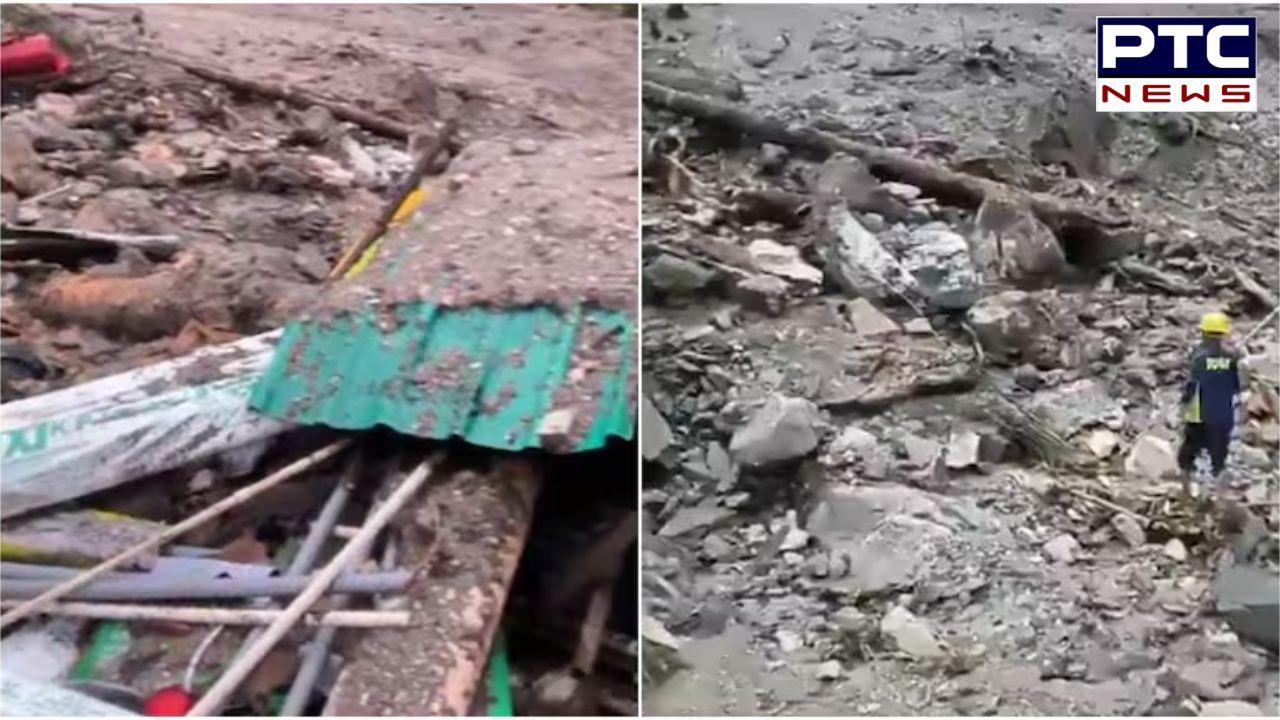
PTC News Desk: Five people have been confirmed dead, and many more are still missing after a cloudburst triggered flash floods and landslides in Uttarakhand’s Uttarkashi district on Tuesday. The sudden surge of water tore through Dharali village near Harsil, destroying homes, hotels, and even parts of an army installation.
Rescue operations are ongoing as teams struggle to locate survivors buried under layers of mud and rubble. Adverse weather conditions and blocked roads have made relief work difficult. Eyewitnesses fear that up to 100 individuals may still be trapped.
Geographic Profile of the Area
The disaster-struck region lies deep in the Garhwal Himalayas, a zone marked by steep slopes, fragile rock formations, and a network of glacier-fed rivers. This geography makes locations like Dharali, Harsil, and Gangotri especially prone to flash floods, landslides, and debris flows.
Rivers such as the Bhagirathi, Alaknanda, Mandakini, Dhauliganga, and Yamuna cut through narrow mountain valleys. Fed by glaciers, these rivers swell rapidly during monsoon months due to heavy rainfall and glacial melt. Human activities such as deforestation, unregulated construction, and road building further worsen the area’s vulnerability to such natural disasters.
Origin and Course of the Bhagirathi River
The Bhagirathi River begins at Gaumukh—the mouth of the Gangotri Glacier—located around 4,000 metres above sea level in Uttarkashi district. From its source, it flows through Gangotri, Harsil, Uttarkashi, and Tehri, taking in tributaries such as Jadh Ganga, Kedar Ganga, and Bhilangna. It eventually meets the Alaknanda River at Devprayag, where the two merge to form the Ganga. Despite the Alaknanda carrying more water, the Bhagirathi holds greater cultural significance as the spiritual source of the Ganga.
Glacial Origins of Major Rivers in Uttarakhand
Along with the Bhagirathi, several other significant rivers in Uttarakhand originate from glaciers. The Alaknanda rises from the Satopanth and Bhagirath Kharak glaciers near Badrinath; the Mandakini emerges from the Chorabari Glacier near Kedarnath; and the Pindar River originates from the Pindari Glacier in the Kumaon region. These rivers flow year-round but swell significantly during the monsoon due to a combination of glacial melting and intense rainfall.
- With inputs from agencies


 claims responsibility, warns of more attacks")


