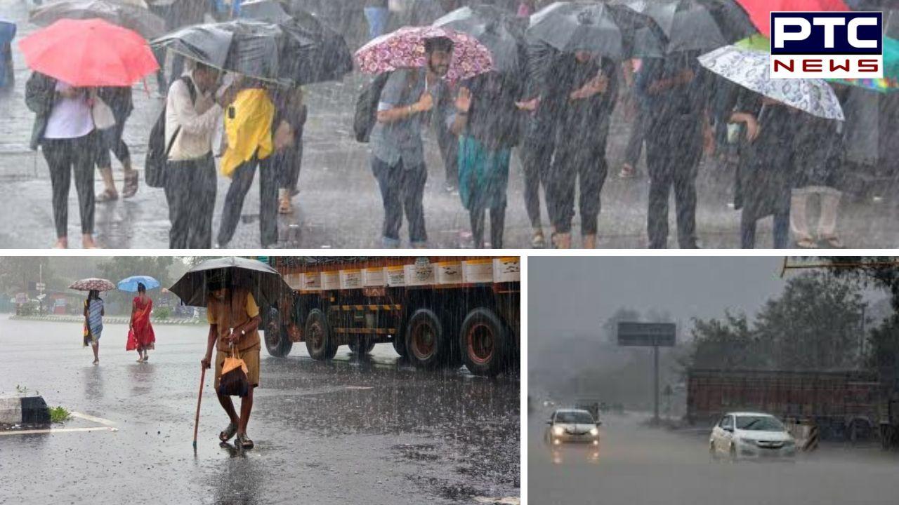
Monsoon to hit Kerala within 24 hours, earliest onset in 16 years; heavy rains forecast across India


PTC Web Desk: The southwest monsoon is expected to make landfall in Kerala within the next 24 hours, arriving nearly a week ahead of its usual schedule of June 1, according to the India Meteorological Department (IMD). This marks the earliest onset in the state since 2009 and 2001, when monsoon showers arrived on May 23.
All meteorological parameters conducive to the monsoon's onset have aligned over Kerala. The past two days have witnessed intense rainfall across various regions of the state, driven by a low-pressure system coupled with the advancing monsoon flow. The IMD has officially confirmed that the monsoon is on the verge of setting in.
The normal date for the monsoon onset over Kerala is June 1. However, historical records show that the earliest-ever arrival occurred on May 11 in 1918, while the most delayed onset was on June 18 in 1972. In the past 25 years, the latest arrival was in 2016, when the rains began on June 9.
Southern India Weather Forecast
With the monsoon nearing, the southern states are bracing for heavy rainfall. The IMD has issued forecasts indicating isolated incidents of extremely heavy rainfall across Kerala, coastal and southern interior Karnataka, as well as Konkan and Goa on Saturday. Kerala and coastal Karnataka are expected to experience persistent heavy to extremely heavy rainfall through May 29, accompanied by gusty winds reaching speeds of 40–50 kmph.
Scattered showers and thunderstorms are also forecast across Tamil Nadu, Telangana, and Andhra Pradesh over the next five days, signalling an active pre-monsoon phase in the southern peninsula.
Western India Weather Forecast
Maharashtra: A depression has formed over the east-central Arabian Sea near the south Konkan coast, located approximately 40 km northwest of Ratnagiri as of early morning on May 24. This system is expected to move eastward and make landfall between Ratnagiri and Dapoli later today.
In response, the IMD has issued a red alert for coastal Maharashtra, predicting intense rainfall. Mumbai is likely to witness thunderstorms accompanied by lightning, with light to moderate rain and gusty winds ranging from 40 to 50 kmph in isolated areas.
Goa
A red alert has also been declared in Goa, where heavy to very heavy rainfall is expected to persist till Sunday. The state government has urged residents to stay away from rivers and waterfalls as a safety measure. The coastal state has already seen heavy showers over the last 24 hours.
Northern India Weather Forecast
Delhi-NCR
In the National Capital Region, light rain is anticipated in parts of South Delhi and surrounding areas in the next few hours, as per an IMD bulletin issued at 5.40 am on Friday. An orange alert remains in place for the region, warning of gusty winds potentially reaching 70 kmph.
Other Northern States
Fairly widespread rain, thunderstorms, and lightning are forecast across Uttarakhand, Himachal Pradesh, and Uttar Pradesh on May 24, with gusts up to 50 kmph. Jammu & Kashmir, Ladakh, Punjab, Haryana, Chandigarh, and Rajasthan are also expected to receive light to moderate rainfall accompanied by gusty winds.
Eastern and Central India Weather Forecast
The IMD has predicted thunderstorms and widespread rainfall for Jharkhand over the coming days, with maximum temperatures expected to remain below normal, between 31°C and 37°C, until May 29.
From May 24 to 26, light to moderate rain with thunderstorms and gusty winds (40–50 kmph) is likely in West Bengal, Sikkim, Madhya Pradesh, Vidarbha, Chhattisgarh, Odisha, and Bihar. Notably, thundersqualls with wind speeds of 50–60 kmph, gusting to 70 kmph, may affect Madhya Pradesh and Bihar today and tomorrow.
Isolated heavy rainfall is also forecast in the following regions:
Andaman & Nicobar Islands: May 24–26
Vidarbha and Chhattisgarh: May 24
Bihar: May 25
Odisha: May 24 and again from May 27–29
Sub-Himalayan West Bengal and Sikkim: May 28–29
- With inputs from agencies