Ayodhya's Ram Temple captured from space: View exclusive satellite images


PTC News Desk: In a momentous revelation ahead of the grand consecration ceremony at Ayodhya, the Indian Space Research Organisation (ISRO) has unveiled captivating images of the magnificent Ram Temple, showcasing a unique aerial perspective from space through indigenous satellites.
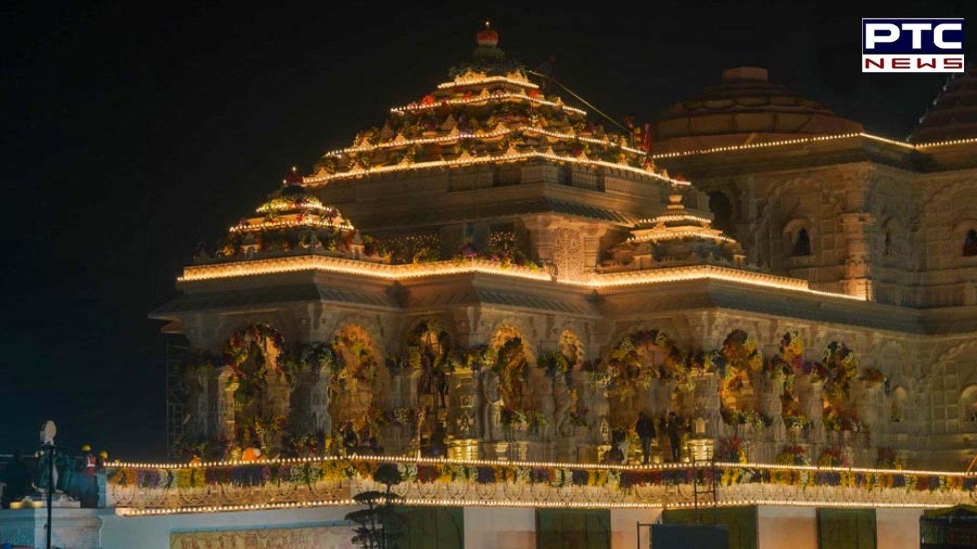
The 2.7-acre Ram Temple site is prominently featured, with an enlarged view provided through the Indian Remote Sensing series of satellites. The captured images date back to December 16 of the previous year, offering a comprehensive overview of the under-construction temple. However, the dense fog over Ayodhya in recent weeks has posed challenges in obtaining a clear and detailed view.
/ptc-news/media/post_attachments/20a344e47d6e9869c222cc43dec9eb01b1f92ed5201cdd1bad422083c7037722.jpg?im=FaceCrop,algorithm=dnn,width=1200,height=738)
The satellite images not only showcase the evolving structure of the temple but also reveal prominent landmarks such as Dashrath Mahal and the meandering Sarayu River. Additionally, the newly renovated Ayodhya railway station stands visibly in the captured imagery.
ISRO's contribution to the Ram Temple project extends beyond visual documentation. The temple's construction faced a significant challenge in determining the precise location for placing the idol of Lord Ram. The trust overseeing the project aimed for the idol to occupy a specific 3 feet by 6 feet space believed to be the birthplace of Lord Ram.
Also Read: PM Modi takes holy dip in Rameswaram amidst Ramayana-inspired temple tour | Checkout his sojourn
Also Read: Republic Day 2024: Know history, significance, theme and chief guest for Jan 26
/ptc-news/media/post_attachments/b28d36fb7c61b27e80bdee5787d94b1a4fd1651c87c2445fbc792a70efdfcb38.jpg?im=FaceCrop,algorithm=dnn,width=1200,height=738)
Alok Sharma, the International Working President of Vishwa Hindu Parishad, shared insights with NDTV, highlighting the complexities arising from the debris covering the birthplace following the Babri Masjid demolition in 1992. To address this, contractors, including construction firm Larsen & Toubro, employed advanced Differential Global Positioning System (GPS)-based coordinates. These precise coordinates, accurate to within 1-3 centimeters, played a crucial role in determining the exact location for placing the statue in the temple's sanctum sanctorum.
The geospatial instruments used in this precision process incorporated signals from India's indigenous 'Navigation with Indian Constellation' (NavIC) satellite constellation—a technological feat by ISRO. The constellation, currently operational with five satellites, is slated for an upgrade, as confirmed by ISRO chairman S Somanath in an interview with NDTV. The NavIC system, often hailed as India's own 'swadeshi GPS,' contributed significantly to the meticulous planning and execution of this revered project, showcasing the synergy between space technology and religious heritage.
Also Read: Maldivian teen dies: President Muizzu allegedly denies approval for Indian plane
Also Read: Dense fog disrupts Delhi travel: Flights and trains delayed, north India shivers
(Inputs from agencies)
-